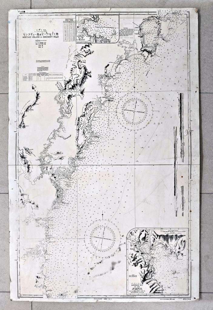
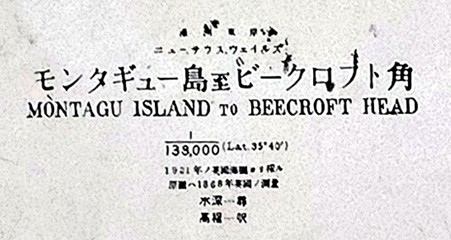
Among the many items in our Museum collection, the Montague Island to Beecroft Head Map stands out.
At first glance, it may resemble the digital copies held by other libraries and museums—but a closer look reveals something unique. Unlike those standard versions, this map has been overlaid with Japanese script.
The original map was produced by the British Admiralty as part of a detailed series mapping the Australian coastline with ocean depths. At some point during the Second World War, the Japanese acquired one of these charts and reproduced it, adding their own headings and annotations.
This particular copy carries an even more personal story. It was discovered in New Guinea, likely by members of the 6th Australian Survey Battery—though it may have been passed to them from another unit. After the war, it made its way back to Australia in the hands of Ron Chesher, a member of the Battery from Moruya.
Other unedited versions of the map:
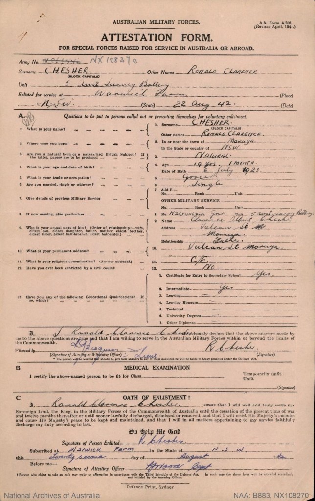
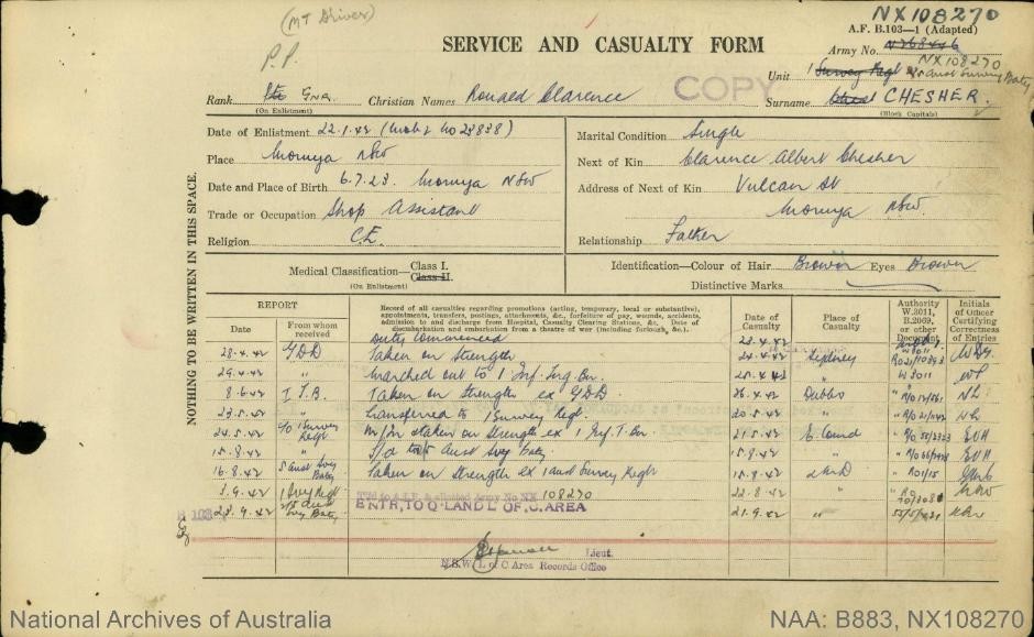
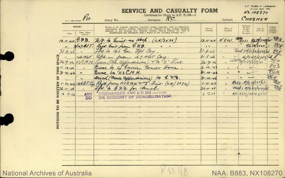
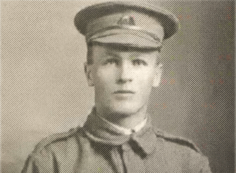
RON CHESHER
Ronald Chesher was 19 years old when he enlisted in the Army in WWII. At the time of enlistment he was working in his father’s grocery story in Moruya.
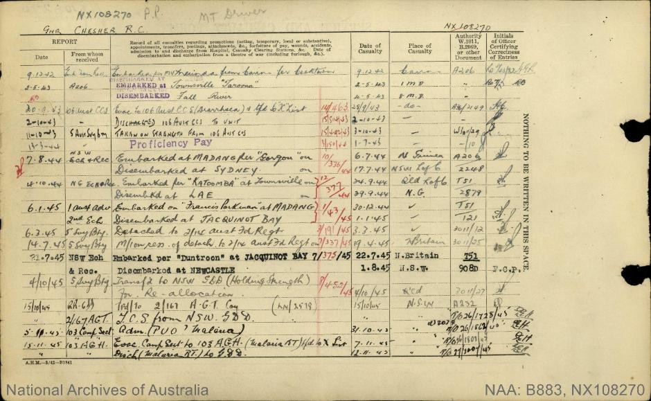
He was posted to the 5th Australian Survey Battery, a specialized artillery unit that provided mapping and surveying support for Australian forces. After training in Northern Queensland, the Unit was posted to New Guinea. Ronald was a Gunner – one of a number with the Survey Unit, responsible for the operation and maintenance of artillery weapons.
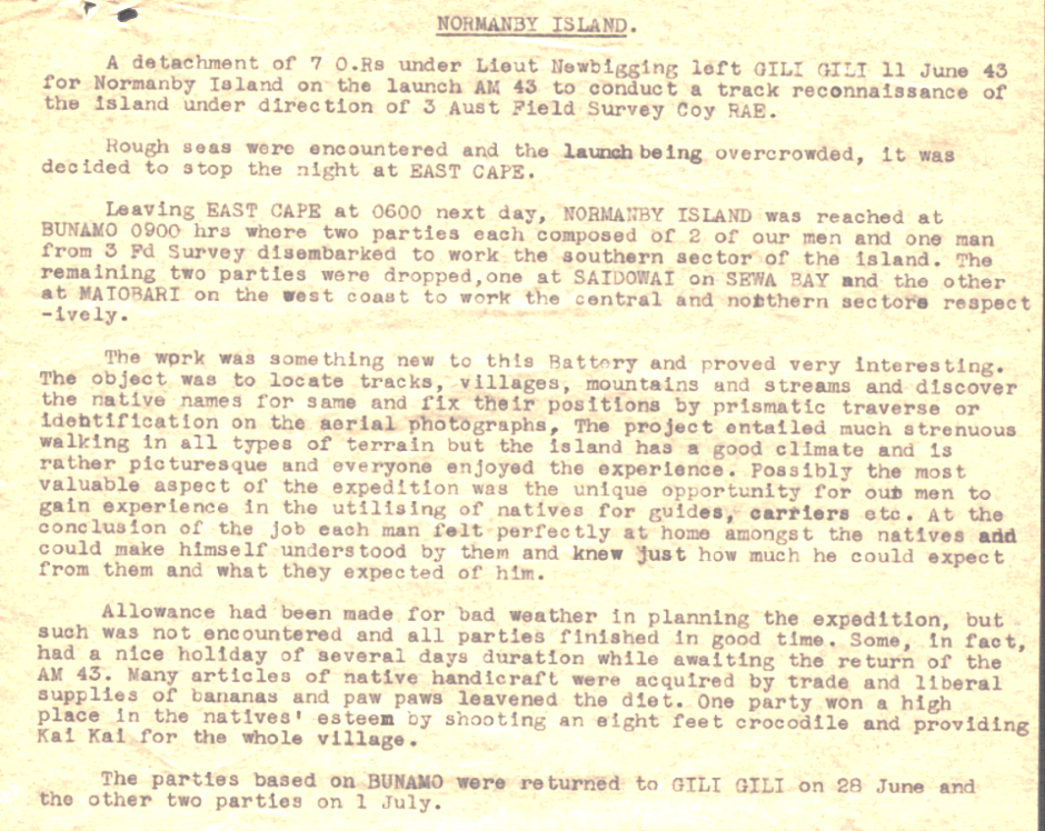
Extracts from the Troop Diary of the 5th Australian Survey Battery
The unit was sent to New Guinea around May 1943, where it focused on surveying and mapping to support artillery operations and troop movements, including projects like the construction of the Madang–Alexishafen Road. In February 1945, it was redeployed to New Britain and was ultimately disbanded in October 1945.

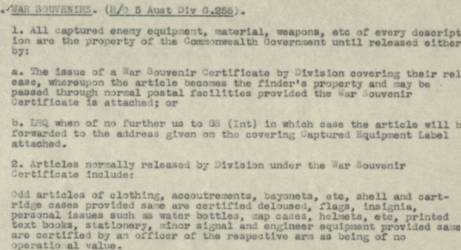
Intelligence and Documents
Throughout 1944, Australian and US forces captured significant intelligence material, including radio sets and documents in the Lae area (November 1944) and around Hollandia (April 1944). These materials were vital for understanding Japanese positions, as noted by the 41st Counter Intelligence Corps (CIC).
Related Posts
-
Private Raymond Bishop of Nerrigundah (1895-1916)
-

Unveiling Culinary History: The Authentic ANZAC Biscuit
-

Leo De Saxe – Moruya’s First ANZAC ?
-
News from 100 years ago – 16 April 1921
-

ANZAC Day jigsaws
-
The Anzac Commemorative Medallion and Badge
-
ANZAC Day – The Origin of the Dawn Service
-

August and World War 1

Leave a Reply