Part of the real pleasure in mounting our latest exhibition A Land of Flooding Rains has been the crowd-sourcing of information, images and anecdotes about the many floods that have occurred in the Moruya District. This information builds up the collective knowledge of our community and can now be preserved.
During the exercise we have come across many unidentified images. So that we can clearly record our visual history, I am entering all of these ‘new’ images onto our database, along with contextual information for each image- date of flood, location, buildings, people etc.
If you can provide any information about any of these images please complete the contact form at the end of this post. Please share this post with friends and family who may be able to recognise these people through similar images in family photographic collections.

Photograph 1 – These boys are having a great time exploring Moruya during one of Moruya’s floods – in either the late 70s or early 80s. Does anyone recognise the boys?

Photograph 2 – This wonderful image of cattle being driven over the bridge, down Vulcan street towards higher ground poses more than one question:
1.Who owned the cattle?
2.Who were the drovers?
2. Who owned the Valiant outside the Adelaide Hotel?

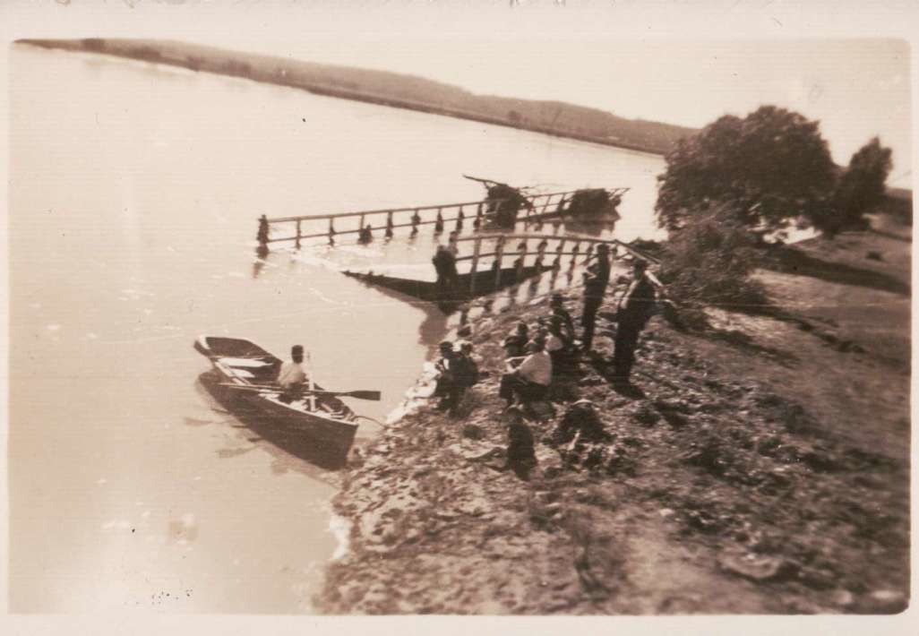
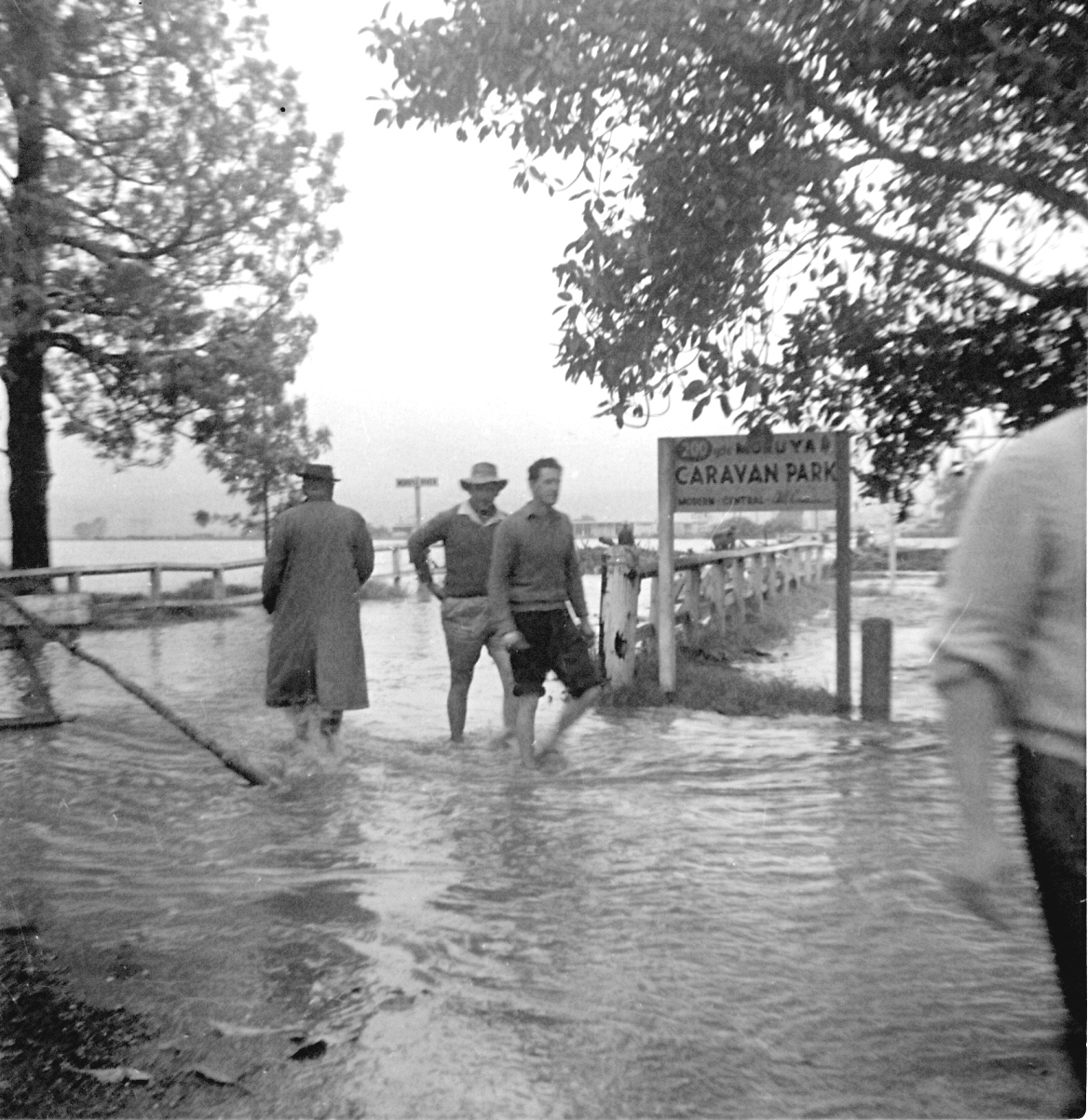
Photograph 3 – It would be wonderful to identify the people inspecting the aftermath of the 1959 flood. They are standing on the southern side of the temporary bridge.
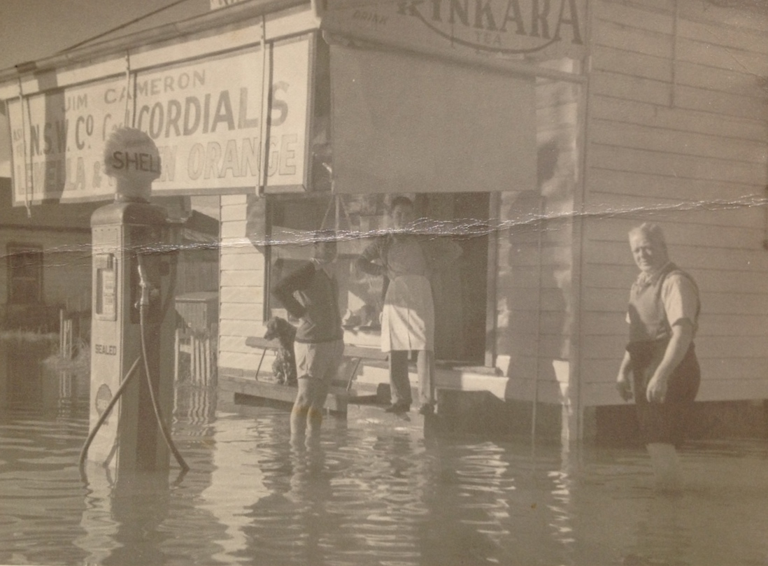
Photograph 4 – Moruya local Vince Honan was able to provide the following information about the location of the garage – the location had many Facebook investigators baffled.
The garage was on the north side of the river, accross from the Pearly Shells (used to be the Criterion hotel).
When I walked to school, the garage was owned (leased) by Don Rose.
The Princes Highway went around the garage to the east, in a curve onto the bridge.
The new bridge was built west of the old bridge and the Highway then went in a straight line.Vince Honan
Can anyone identify the men in the photo?
Photograph 5 – In 1945 there were floods throughout the whole area in April. The second bridge had survived the floods of 1922, 1925, 1934, 1941, 1942 and 1944 but this one was too much for it and it was destroyed.
It would be wonderful if we were able to identify the people in the photo above. They are inspecting part of the southern side of the bridge washed up beside where Riverside Park is today.
Photograph 6 – To the best of our knowledge this house is in the lower section of Campbell Street ( near Flanagan Lane) and the Dalton family was living in it at the time of this flood. Can anyone identify the girl on the verandah?
Photograph 7 – Do any of these men, photographed inspecting the flooding in 1962, are?
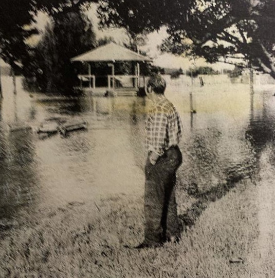
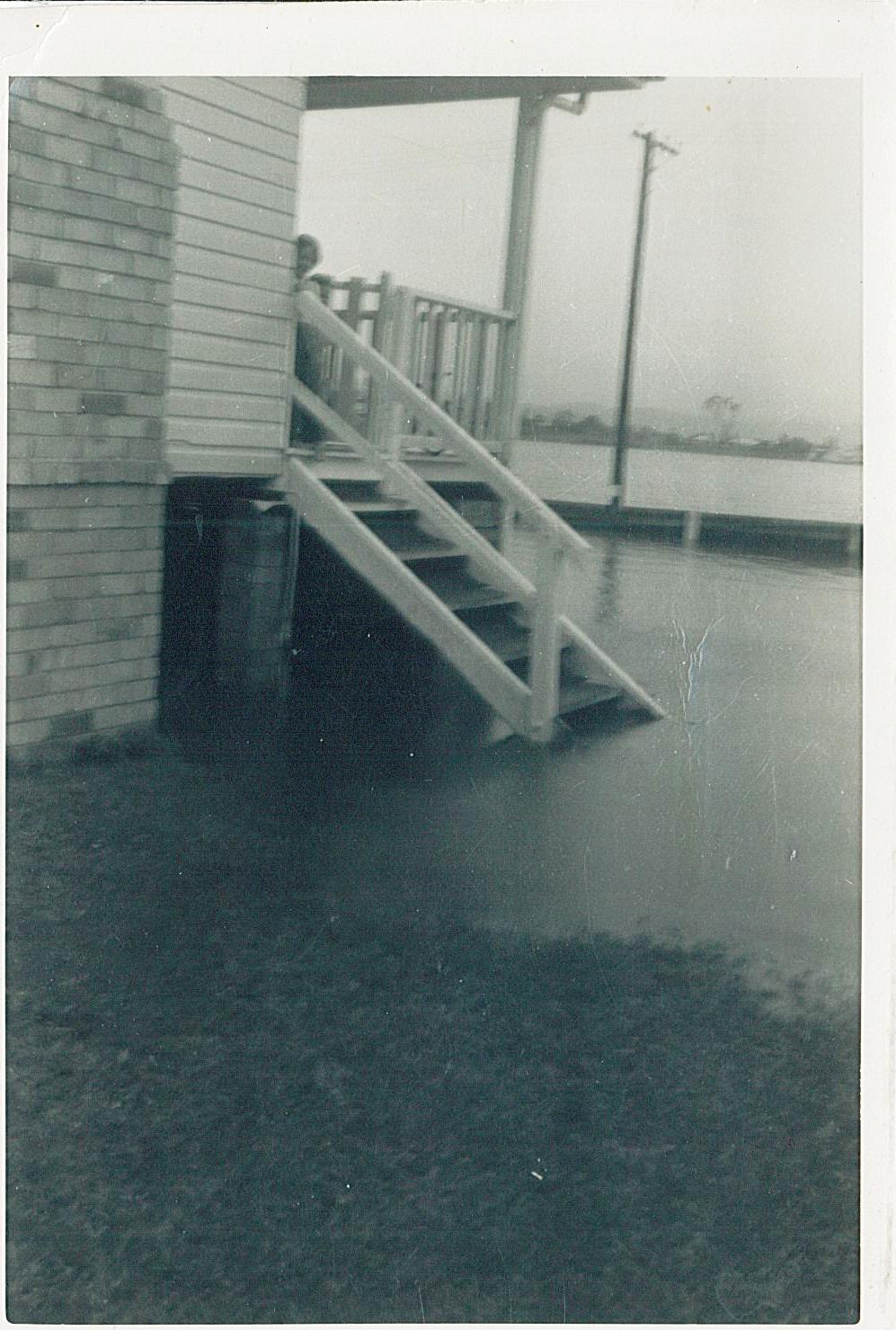
Photograph 8 – Can anyone identify this man who is carefully inspecting the river level at the rotunda?
Don’t forget that the exhibition will be open at the following times:
Friday 22 May from 11am – 1 pm
Saturday 23 May 23 from 11 am to 4 pm.
Sunday 24 May from 11 am to 4 pm.
Please enter any information about the photographs on the form below. Your email address will not be displayed at any time.
Many thanks in anticipation
Brian Harris, MDHS.


Leave a Reply